Natural Science
The Geology of the Uwharries and Origin of Morrow Mountain Rhyolite
The Uwharrie region of North Carolina includes the Uwharrie National Forest in Montgomery, Davidson, Randolph County, and Morrow Mountain State Park in Stanly County. The National Forest and the State Park have connected over 70,000 acres, which includes a significant amount of former Alcoa lands along the Yadkin River preserved by Three Rivers Land Trust.

Despite popular belief stating the Uwharries are one of the oldest mountain chains on Earth, the Uwharrie region is far younger than the over one billion years old Appalachian Mountains. The Uwharrie Mountains were formed around 550 to 600 million years ago as an ancient volcanic island arc system in what was originally ancient Africa. This volcanic area broke away from Africa as an island that drifted towards South America’s Amazon region and, eventually, through the process of plate tectonics the island drifted slowly across an ancient seaway and slammed into North America about 450 million years ago.
Dr. Chris Tacker of the North Carolina Museum of Natural Sciences said of the Uwharrie Mountains: “It is like the zebra mussel. It is like kudzu. It is exotic to North America. It did not form near North America. It just ended up here. It originally formed as part of the assembly of the supercontinent Pangea. It was stuck off of Africa and South America, where the two of those were joined together. It broke loose and traveled, I guess we can call it, in modern day coordinates, west towards North America."
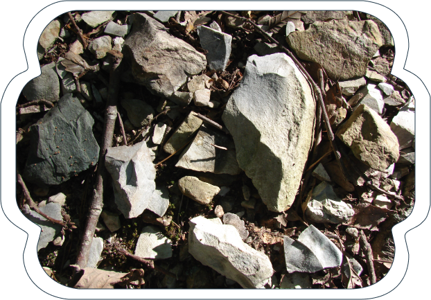
The Uwharrie Mountains we see now are what is left of these islands after millions of years of erosion of the ash, lava rock, and soil. The hard cores of these volcanoes, once many feet underground, are all that remain. A geologist, Robert Butler and archaeologist, Dr. Randolph Daniel located and described many of those volcanic cores throughout the region to be rhyolite ancient quarry sites utilized by American Indians. However, it was the unique metamorphized, cryptocrystalline, high percent quartz, with very little phenocryst, rhyolite found near the top of Morrow Mountain that, according to Randy Daniel, was used to create over 75% of the projectile points found at the Hardaway Site. While other forms of rhyolite in the Uwharries were plentiful and suitable for making projectile points, it was Morrow Mountain’s rhyolite that created exceptional projectile points that maintained extremely sharp edges and ideal penetration potential. These projectile points, knapped and completed at the Hardaway Site, have been identified all across the Central Piedmont of what is now North Carolina, South Carolina, and parts of Virginia. American Indians had great expertise in finding the best stone for making tools, and once they located the ideal stone over a broad region, like Morrow Mountain's rhyolite, they returned regularly to that quarry site and the nearby Hardaway Site for around 13,000 years.
We will never know why American Indians did not regularly camp at the base of Morrow Mountain. A plausible explanation is because of the abundant shad and other anadromous fish at the Narrows of the Yadkin – “a place like no other anywhere in the South” with remarkably violent rapids, high cliffs, long views, and teeming with spawning fish. Over thousands of years, many tons of rhyolite were carried by American Indians from Morrow Mountain over five miles to the Hardaway Site. Just recently the Office of State Archaeology identified several archaeological areas between Morrow Mountain and the Hardaway Site that American Indians probably used as initial stone shaping and knapping areas along the five-mile route. They also recently used water adaptive ground penetrating radar to locate additional ancient fish weirs in areas of the Yadkin River just east of the Narrows of the Yadkin.
In an article supplied by NOAA: 1898 Report of Commissioner, U.S. Commission of Fish and Fisheries: P. 119, “The principal shad streams (in the Southern US) are the St. Johns, Altamaha, Ogeechee, Savannah, Edisto, Pee Dee, and Cape Fear.”, P: 110, “In their migration up rivers shad ascend the stream until the volume of the water forming the channel of the river becomes quite inconsiderable, or, as is frequently the case, until the movements are arrested by impassable falls, dams, or other obstructions.” Such conditions as impassable falls and rapids, were often the case at the Narrows of the Yadkin even though at high water times some shad made it over “451 miles up the Yadkin to Wilkesboro.” P.106, “The young fry, hatched out in the rivers in spring and early summer, remain there until the following fall, when they leave for the ocean and nothing more is seen of them until the return to the estuaries as mature or nearly mature fish supposed to be two or three years old."

